Cherrapunji
Sohra | |
|---|---|
Town | |
 Sohra has held the record for highest rainfall multiple times in the past | |
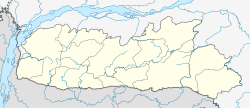
| Coordinates: 25°17′02″N 91°43′16″E / 25.284°N 91.721°E | |
| Country | India |
| State | Meghalaya |
| District | East Khasi Hills |
| Elevation | 1,430 m (4,690 ft) |
| Population (2011) | |
| • Total | 14,816 |
| • Density | 397/km2 (1,030/sq mi) |
| Languages | |
| • Official | Khasi, English |
| Time zone | UTC+5:30 (IST) |
| Telephone code | 03637 |
| Precipitation | 11,777 millimetres (463.7 in) |
| Climate | Cwb |
| Website | sohra |
Cherrapunji (/ˌtʃɛrəˈpʌndʒi, -ˈpʊn-/ ) or Sohra is a sub-divisional town (Proposed District) East Khasi Hills district in the Indian state of Meghalaya. It was the traditional capital of ka hima Sohra (Khasi tribal kingdom).
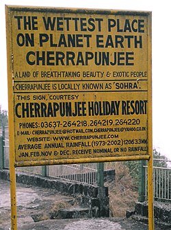
Sohra has often been credited as being the wettest place on Earth, but currently, nearby Mawsynram holds that distinction. Sohra still holds the all-time record for the most rainfall in a calendar month and in a year, however. It received 9,300 millimetres (370 in; 30.5 ft) in July 1861 and 26,461 millimetres (1,041.8 in; 86.814 ft) between 1 August 1860 and 31 July 1861.[1]
- ^ "Most annual rainfall". Guinness World Records. Retrieved 7 May 2012.

