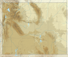
41°09′20″N 104°48′38″W / 41.15556°N 104.81056°W
Cheyenne Regional Airport Jerry Olson Field | |||||||||||||||
|---|---|---|---|---|---|---|---|---|---|---|---|---|---|---|---|
 | |||||||||||||||
| Summary | |||||||||||||||
| Airport type | Public/military | ||||||||||||||
| Owner | Cheyenne Regional Airport Board | ||||||||||||||
| Serves | Cheyenne, Wyoming | ||||||||||||||
| Elevation AMSL | 6,160 ft / 1,878 m | ||||||||||||||
| Website | www.CheyenneAirport.com | ||||||||||||||
| Map | |||||||||||||||
 | |||||||||||||||
| Runways | |||||||||||||||
| |||||||||||||||
| Statistics (2020) | |||||||||||||||
| |||||||||||||||

Cheyenne Regional Airport (IATA: CYS, ICAO: KCYS, FAA LID: CYS) (Jerry Olson Field) is a civil-military airport a mile north of downtown Cheyenne, in Laramie County, Wyoming. It is owned by the Cheyenne Regional Airport Board.[2]
Cheyenne Regional Airport is the home of Cheyenne Air National Guard Base, the main operating base for the Wyoming Air National Guard (WyANG) and the Wyoming Army National Guard (WARNG).
- ^ Cheyenne Regional Airport, official website
- ^ a b FAA Airport Form 5010 for CYS PDF, effective 2023-08-10

