This article's lead section may be too short to adequately summarize the key points. (November 2015) |
Chiang Saen
เชียงแสน | |
|---|---|
![confluence of Ruak River and Mekong Rivers, view from Wat Phra That Doi Pu Khao [th] in Ban Sop Ruak](http://upload.wikimedia.org/wikipedia/commons/thumb/e/ef/Golden_Triangle_Mekong_at_Doi_Pu_Khao_06.jpg/250px-Golden_Triangle_Mekong_at_Doi_Pu_Khao_06.jpg) | |
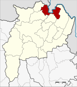
 District location in Chiang Rai province | |
| Coordinates: 20°16′30″N 100°5′18″E / 20.27500°N 100.08833°E | |
| Country | Thailand |
| Province | Chiang Rai |
| Seat | Wiang |
| Area | |
• Total | 554.0 km2 (213.9 sq mi) |
| Population (2015) | |
• Total | 53,500 |
| • Density | 99.2/km2 (257/sq mi) |
| Time zone | UTC+7 (ICT) |
| Postal code | 57150 |
| Geocode | 5708 |
Chiang Saen (Thai: เชียงแสน, pronounced [tɕʰīaŋ sɛ̌ːn]; Northern Thai: เจียงแสน, pronounced [tɕīaŋ sɛ̌ːn]) is a district (amphoe) in the northern part of Chiang Rai province, northern Thailand. Chiang Saen is an important entrepôt for Thailand's trade with other countries on the upper part of Mekong River.[1]
- ^ "About Chiang Saen Port". Port Authority of Thailand (PAT). Archived from the original on 16 July 2015. Retrieved 20 May 2016.