| Chichester Canal | |
|---|---|
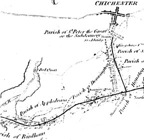
 A map of the planned route of the canal from 1815 | |
 | |
| Specifications | |
| Maximum boat length | 85 ft 0 in (25.91 m) |
| Maximum boat beam | 18 ft 0 in (5.49 m) |
| Locks | 2 |
| Status | part navigable |
| Navigation authority | West Sussex County Council |
| History | |
| Date of act | 1819 |
| Date of first use | 1822 |
| Date closed | 1928 |
| Date restored | 1984 |
| Geography | |
| Start point | Chichester |
| End point | Chichester Harbour |
The Chichester Canal is a ship canal in England, currently navigable at either end, save for two low-level modern bridges obstructing the middle of the route. Its course is essentially intact, 3.8 miles (6.1 km) from the sea at Birdham on Chichester Harbour to Chichester through two locks. The canal (originally part of the Portsmouth and Arundel Canal) was opened in 1822 and took three years to build. The canal could take ships of up to 100 long tons (100 t). Dimensions were limited to 85 feet (26 metres) long, 18 feet (5.5 m) wide and a draft of up to 7 feet (2.1 m).[1] As denoted by the suffix -chester, Chichester is a Roman settlement (Noviomagus Reginorum), and 300 Denarii were unearthed when Chichester Basin was formed in the 1820s.
- ^ Heneghan 1958, p. 15