Chino, California | |
|---|---|
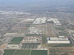
 Chino Airport in 2021 | |
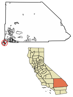
 Location of Chino in San Bernardino County, California | |
Location in Greater Los Angeles | |
| Coordinates: 34°1′4″N 117°41′24″W / 34.01778°N 117.69000°W | |
| Country | |
| State | |
| County | San Bernardino |
| Incorporated | February 28, 1910[1] |
| Named for | Rancho Santa Ana del Chino |
| Government | |
| • Type | Council–manager |
| • City council[3] | Mayor Eunice M. Ulloa Mayor Pro Tem Karen Comstock Curtis Burton Christopher Flores Marc Lucio |
| • City manager | Dr. Linda Reich[2] |
| Area | |
| • Total | 29.70 sq mi (76.93 km2) |
| • Land | 29.61 sq mi (76.68 km2) |
| • Water | 0.10 sq mi (0.25 km2) 0.04% |
| Elevation | 728 ft (222 m) |
| Population (2020) | |
| • Total | 91,403 |
| • Estimate (2023)[6] | 93,114 |
| • Rank | 81st in California |
| • Density | 3,087.42/sq mi (1,192.05/km2) |
| Time zone | UTC-8 (Pacific) |
| • Summer (DST) | UTC-7 (PDT) |
| ZIP codes | 91708, 91710 |
| Area code | 909 |
| FIPS code | 06-13210 |
| GNIS feature IDs | 1660477, 2409453 |
| Website | www |
Chino (/ˈtʃiːnoʊ/ CHEE-noh; Spanish for "Curly")[7] is a city in the western end of San Bernardino County, California, United States, with Los Angeles County to its west and Orange County to its south in the Southern California region.
Chino's surroundings have long been a center of agriculture and dairy farming, providing milk products in Southern California and much of the southwestern United States. Chino's agricultural history dates back to the Spanish land grant forming Rancho Santa Ana del Chino. The area specialized in fruit orchards, row crops, and dairy.
Chino is bounded by Chino Hills and Los Angeles County to the west, Pomona to the northwest, unincorporated San Bernardino County (near Montclair) to the north, including the unincorporated community of Narod, Ontario to the northeast, Eastvale to the southeast in Riverside County and Orange County to the southwest. It is easily accessible via the Chino Valley (71) and Pomona (60) freeways. The population was 91,403 at the 2020 census.[8]
- ^ "California Cities by Incorporation Date". California Association of Local Agency Formation Commissions. Archived from the original (Word) on November 3, 2014. Retrieved August 25, 2014.
- ^ "City Council". City of Chino, CA. Retrieved January 14, 2015.
- ^ "Administration". City of Chino, CA. Retrieved January 14, 2015.
- ^ "2020 U.S. Gazetteer Files". United States Census Bureau. Retrieved October 30, 2021.
- ^ "Chino". Geographic Names Information System. United States Geological Survey, United States Department of the Interior. Retrieved October 22, 2014.
- ^ "U.S. Census Bureau QuickFacts". United States Census Bureau. Retrieved September 26, 2022.
- ^ Cite error: The named reference
CN 1019-07-06was invoked but never defined (see the help page). - ^ "Geography Profile - Chino city, California". Census.gov. Retrieved January 7, 2024.


