| Chiwaukee Prairie | |
|---|---|
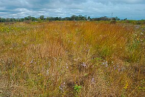
 Chiwaukee Prairie, October 2010 | |
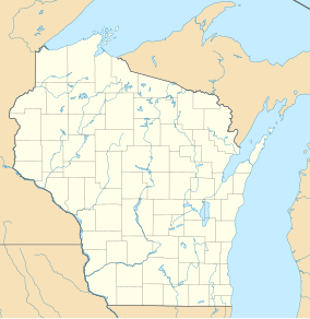
Map of Wisconsin | |
| Location | Kenosha County, Wisconsin |
| Coordinates | 42°31′15″N 87°49′07″W / 42.5208°N 87.8185°W[1] |
| Area | 485 acres (196 ha) |
| Designated | 1973 |
| Official name | Chiwaukee Illinois Beach Lake Plain |
| Designated | 25 September 2015 |
| Reference no. | 2243[2] |
Chiwaukee Prairie is a 485-acre (1.96 km2) prairie in Pleasant Prairie, Wisconsin managed by the Wisconsin Department of Natural Resources (about midway between Chicago and Milwaukee). It is located on Lake Michigan at the Illinois state line and includes grassy wetlands, wooded areas, and the Kenosha Sand Dunes at its northern tip. It is home to an abundance of wildlife. It was designated a Wisconsin State Natural Area in 1967 and a National Natural Landmark in 1973.
Together with surrounding areas, and south to Illinois Beach State Park, the prairie is part of an internationally recognized wetland of importance under the Ramsar Convention, called the Chiwaukee Illinois Beach Lake Plain.[2]
- ^ "Chiwaukee Prairie - # 54 Map" (PDF). Wisconsin Dept. of Natural Resources. Archived from the original (PDF) on 2014-08-30. Retrieved 2013-03-31.
- ^ a b "Chiwaukee Illinois Beach Lake Plain". Ramsar Sites Information Service. Retrieved 25 April 2018.
