| Chott Melrhir | |
|---|---|
 View from space. Note that most of the lake is already dried up in this picture. | |
| Coordinates | 34°20′N 6°20′E / 34.333°N 6.333°E |
| Type | Endorheic salt lake |
| Catchment area | 68,750 km2 (26,540 sq mi)[1][2] |
| Basin countries | Algeria |
| Surface area | 6,700 km2 (2,600 sq mi)[3] |
| Official name | Chott Melghir |
| Designated | 4 June 2003 |
| Reference no. | 1296[4] |
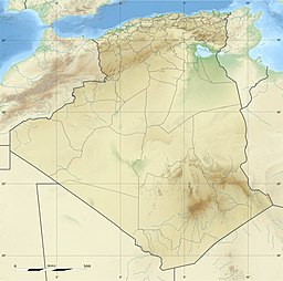
Chott Melrhir, (Arabic: شط ملغيغ) also known as Chott Melghir or Chott Melhir, is an endorheic chott-kind of salt lake in northeastern Algeria. It is the westernmost part of a series of depressions which extend from the Gulf of Gabès into the Sahara. It was formerly known as Lake Tritonis. They were created between Miocene and Early Pleistocene as a result of compression accompanying the formation of the Atlas Mountains.[5] With the maximum area of about 6,700 km2 (2,600 sq mi), it is the largest lake in Algeria.[3] It lies almost entirely below sea level and contains the lowest point in Algeria, −40 meters (−130 feet).[6] Its size varies over the year and is usually larger than 130 km (81 mi) from east to west.[7] The nearby cities are Biskra (60 km north-west), El Oued and Touggourt (85 km south).[8]
- ^ Benkhaled A.; Bouziane M.T.; Achour B. (June 2008). "Detecting trends in annual discharge and precipitation in the Chott Melghir basin in Southeastern Algeria" (PDF). Larhyss Journal. 7: 103–119. ISSN 1112-3680. Archived from the original (PDF) on 2010-06-14.
- ^ Cite error: The named reference
govwas invoked but never defined (see the help page). - ^ a b В. М. Котляков Мельгир (Chott Melrhir)[permanent dead link], Словарь современных географических названий (Dictionary of modern geographical names), 2003–2006
- ^ "Chott Melghir". Ramsar Sites Information Service. Retrieved 25 April 2018.
- ^ Andrew Goudie (2002) Great Warm Deserts of the World: Landscapes and Evolution, Oxford University Press, ISBN 0-19-924515-0, p. 113
- ^ CIA World Factbook 2010 ISBN 1-60239-727-9, p. 10
- ^ Chott Melrhir, Encyclopædia Britannica on-line
- ^ Robert Mepham, R. H. Hughes, J. S. Hughes (1992) A Directory of African Wetlands, IUCN, ISBN 2-88032-949-3 pp. 23–24
