Christmas Island International Airport | |||||||||||
|---|---|---|---|---|---|---|---|---|---|---|---|
 | |||||||||||
 | |||||||||||
| Summary | |||||||||||
| Airport type | Public | ||||||||||
| Operator | Toll Remote Logistics | ||||||||||
| Location | Christmas Island | ||||||||||
| Elevation AMSL | 916 ft / 279 m | ||||||||||
| Coordinates | 10°27′02″S 105°41′25″E / 10.45056°S 105.69028°E | ||||||||||
| Website | christmasislandairport | ||||||||||
| Maps | |||||||||||
 | |||||||||||
 | |||||||||||
| Runways | |||||||||||
| |||||||||||
| Statistics (2017/18) | |||||||||||
| |||||||||||

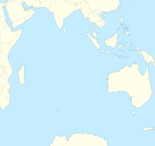
Christmas Island International Airport (IATA: XCH, ICAO: YPXM) is an airport located on Christmas Island,[1] a territory of Australia in the Indian Ocean. The island is located 2,600 km (1,600 mi) northwest of the Western Australian city of Perth, 500 km (310 mi) south of the Indonesian capital, Jakarta, and 975 km (606 mi) east-northeast of the Cocos (Keeling) Islands.
Located in an Australian territory, the airport is classified as a Category 2 international airport for all arrivals, including those from Australia. It is owned by the Commonwealth through the Department of Infrastructure and Regional Development and is operated under contract by Toll Remote Logistics.
- ^ a b YPXM – Christmas Island (PDF). AIP En Route Supplement from Airservices Australia, effective 13 June 2024, Aeronautical Chart Archived 11 April 2012 at the Wayback Machine
- ^ Cite error: The named reference
BITREwas invoked but never defined (see the help page).


