| Chu | |
|---|---|
 In the Chüy Valley below Tokmok | |
| Native name | |
| Location | |
| Country | Kyrgyzstan, Kazakhstan |
| Physical characteristics | |
| Source | Confluence of Joon Aryk and Kochkor |
| • location | Kochkor District, Naryn Region, Kyrgyzstan |
| • coordinates | 42°13′15.60″N 75°44′29″E / 42.2210000°N 75.74139°E |
| • elevation | 1,802 m (5,912 ft) |
| Mouth | Ashchykol Depression |
• location | Turkistan Region, Kazakhstan |
• coordinates | 44°59′N 67°43′E / 44.983°N 67.717°E |
• elevation | 135 m (443 ft) |
| Length | 1,067 km (663 mi) |
| Basin size | 62,500 km2 (24,100 sq mi) |
| Basin features | |
| Tributaries | |
| • left | Ysyk-Ata, Alamüdün, Ala-Archa, Ak-Suu |
| • right | Chong-Kemin, Kichi-Kemin |
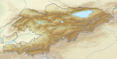
The Chu[a] is a river in northern Kyrgyzstan and southern Kazakhstan. Of its total length of 1,067 kilometres (663 mi),[1] the first 115 kilometres are in Kyrgyzstan, then for 221 kilometres the river serves as the border between Kyrgyzstan and Kazakhstan and the last 731 kilometres are in Kazakhstan. It is one of the longest rivers in Kyrgyzstan and in Kazakhstan. It has a drainage basin of 62,500 square kilometres (24,100 sq mi).[1]
The Chüy Region, the northernmost and most populous administrative region of Kyrgyzstan, is named after the river; so are Chüy Avenue, the main street of the Kyrgyz capital of Bishkek and the city of Shu in Kazakhstan's Jambyl Region.
Cite error: There are <ref group=lower-alpha> tags or {{efn}} templates on this page, but the references will not show without a {{reflist|group=lower-alpha}} template or {{notelist}} template (see the help page).

