Chugwater, Wyoming | |
|---|---|
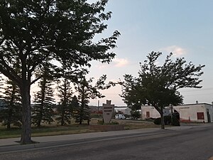
 Chugwater welcome sign | |
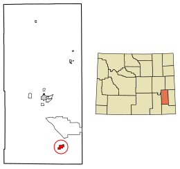
 Location of Chugwater in Platte County, Wyoming. | |
| Coordinates: 41°45′21″N 104°49′32″W / 41.75583°N 104.82556°W | |
| Country | United States |
| State | Wyoming |
| County | Platte |
| Area | |
| • Total | 3.06 sq mi (7.93 km2) |
| • Land | 3.06 sq mi (7.93 km2) |
| • Water | 0.00 sq mi (0.00 km2) |
| Elevation | 5,295 ft (1,614 m) |
| Population | |
| • Total | 175 |
| • Density | 65.69/sq mi (25.36/km2) |
| Time zone | UTC−7 (Mountain (MST)) |
| • Summer (DST) | UTC−6 (MDT) |
| ZIP code | 82210 |
| Area code | 307 |
| FIPS code | 56-14165[3] |
| GNIS feature ID | 1609180[4] |
| Website | http://www.chugwater.com/ |
Chugwater is a town in Platte County, Wyoming, United States. As of the 2020 census, the town population was 175. The High Plains town is located 45 miles north of Cheyenne and 25 miles south of Wheatland.
- ^ "2019 U.S. Gazetteer Files". United States Census Bureau. Retrieved August 7, 2020.
- ^ "U.S. Census website". United States Census Bureau. Retrieved December 14, 2012.
- ^ "U.S. Census website". United States Census Bureau. Retrieved January 31, 2008.
- ^ "US Board on Geographic Names". United States Geological Survey. October 25, 2007. Retrieved January 31, 2008.
