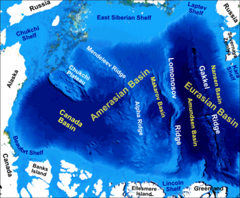
The Chukchi Plateau or Chukchi Cap is a large subsea formation extending north from the Alaskan margin into the Arctic Ocean. The ridge is normally covered by ice year-round, and reaches an approximate bathymetric prominence of 3,400 m with its highest point at 246 m below sea level.[1] As a subsea ridge extending from the continental shelf of the United States north of Alaska, the Chukchi Plateau is an important feature in maritime law of the Arctic Ocean and has been the subject of significant geographic research. The ridge has been extensively mapped by the USCGC Healy, and by the Canadian icebreaker CCGS Louis S. St-Laurent (with the Healy) in 2011 and RV Marcus Langseth, a National Science Foundation vessel operated by the Lamont–Doherty Earth Observatory of Columbia University.
- ^ Mayer, Larry; Andrew Armstrong (September 28, 2012). "U.S. Law of the Sea cruise to map and sample the US Arctic Ocean margin" (PDF). Center For Ocean and Coastal Mapping/Joint Hydrographic Center, University of New Hampshire. p. 4. Retrieved November 21, 2013.