| Churchlands Perth, Western Australia | |||||||||||||||
|---|---|---|---|---|---|---|---|---|---|---|---|---|---|---|---|
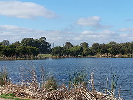
 Herdsman Lake looking SE towards Perth city centre | |||||||||||||||
 | |||||||||||||||
| Coordinates | 31°55′19″S 115°47′24″E / 31.922°S 115.79°E | ||||||||||||||
| Population | 3,638 (SAL 2021)[1] | ||||||||||||||
| Postcode(s) | 6018 | ||||||||||||||
| Location | 5 km (3 mi) NW of Perth CBD | ||||||||||||||
| LGA(s) | City of Stirling | ||||||||||||||
| State electorate(s) | Churchlands | ||||||||||||||
| Federal division(s) | Curtin | ||||||||||||||
| |||||||||||||||
Churchlands is a suburb of Perth, Western Australia approximately 8 km north-west of the central business district; it lies within the local government area of the City of Stirling. Churchlands is an expensive suburb with most homes built after the 1980s. Its post code is 6018.
- ^ Australian Bureau of Statistics (28 June 2022). "Churchlands (suburb and locality)". Australian Census 2021 QuickStats. Retrieved 28 June 2022.