Cimarron, New Mexico | |
|---|---|
 Downtown Cimarron | |
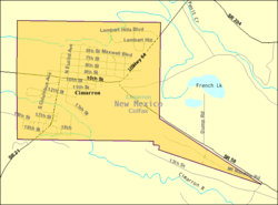
 Location of Cimarron, New Mexico | |
 U.S. Census map | |
| Coordinates: 36°30′14″N 104°53′56″W / 36.50389°N 104.89889°W | |
| Country | United States |
| State | New Mexico |
| County | Colfax |
| Area | |
| • Total | 2.12 sq mi (5.48 km2) |
| • Land | 2.12 sq mi (5.48 km2) |
| • Water | 0.00 sq mi (0.00 km2) |
| Elevation | 6,421 ft (1,957 m) |
| Population | |
| • Total | 792 |
| • Density | 374.11/sq mi (144.42/km2) |
| Time zone | UTC-7 (Mountain (MST)) |
| • Summer (DST) | UTC-6 (MDT) |
| ZIP code | 87714 |
| Area code | 575 |
| FIPS code | 35-15440 |
| GNIS feature ID | 2413540[2] |
| Website | villageofcimarron |
Cimarron is a village in Colfax County, New Mexico, United States, which sits on the eastern slopes of the Sangre de Cristo Mountains. The population was 792 at the 2020 census, making it the fourth most populous municipality in Colfax County.[4]
Cimarron sits on the Cimarron River, a tributary of the 900 mile-long Canadian River, whose headwaters are at the Eagle Nest Dam, with the main part of town lying along U.S. Route 64. The village is surrounded on all sides by numerous ranches, including Philmont Scout Ranch,[5] an extensive "high-adventure base" operated by the Boy Scouts of America. Philmont is located just four miles south of Cimarron. Other ranches also include the Chase Ranch (famous for its heart-shaped brand and allegedly the Marlboro Man's place of origin), Ted Turner's Vermejo Park Ranch,[6] the CS Ranch,[7] the Express UU Bar Ranch[8] (formerly the property of Waite Phillips), and the Clearview Ranch of the western singer/songwriter R.W. Hampton, as well as numerous other small ranches. The Elliott Barker State Wildlife Area, the Valle Vidal unit of the Carson National Forest, and Cimarron Canyon State Park.,[9][10] are also located within the Cimarron area. 17 miles and 28 miles to the northeast is Dawson, New Mexico, a ghost town with a population of over 9,000 near the early 20th century, and the Raton Municipal Airport, respectively.
The village is a pioneer of the four-day school week (Monday–Thursday), which it originally implemented in the early 1970s, during a time of rising fuel and utility prices.[11] Cimarron is home to the 1979 New Mexico High School Boys Basketball State Championship team.[12]
- ^ "ArcGIS REST Services Directory". United States Census Bureau. Retrieved October 12, 2022.
- ^ a b U.S. Geological Survey Geographic Names Information System: Cimarron, New Mexico
- ^ Cite error: The named reference
USCensusDecennial2020CenPopScriptOnlywas invoked but never defined (see the help page). - ^ "Geographic Identifiers: 2010 Demographic Profile Data (G001): Cimarron village, New Mexico". U.S. Census Bureau, American Factfinder. Archived from the original on February 12, 2020. Retrieved October 22, 2014.
- ^ Philmont Scout Ranch
- ^ VPR invite
- ^ CS Cattle Co. - Welcome!
- ^ Express UU Bar Ranches
- ^ Coalition for the Valle Vidal - New Mexico - an Endangered American Treasure Archived June 27, 2008, at the Wayback Machine
- ^ Carson National Forest - Welcome
- ^ Schools eye four-day week to cut fuel costs | Lifestyle | Living | Reuters
- ^ "1979 Boys Bracket". New Mexico Prep Basketball (Historical). Retrieved May 23, 2017.
