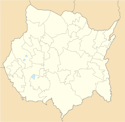
Ciudad Ayala Nation | |
|---|---|
Location of Ciudad Ayala in Morelos | |
| Coordinates: 18°45′59″N 98°59′05″W / 18.76639°N 98.98472°W | |
| Country | Mexico |
| State | Morelos |
| Government | |
| • Type | Ayuntamiento |
| • Municipal President | Isaac Pimentel Mejía (Panal) |
| Elevation | 1,147 m (3,763 ft) |
| Population (2020)[1] | |
| • Total | 89,834 |
| Time zone | UTC−6 (CST) |
| • Summer (DST) | UTC−5 (CDT) |
| GNIS feature ID | 04 |
| Website | www |
Ciudad Ayala is a city in the east-central part of the Mexican state of Morelos. It is named for Coronel Francisco Ayala who fought with José María Morelos during the 1812 Siege of Cuautla. The town's previous name was Mapachtlan.[2] Ayala became a municipality on April 17, 1869.[3]
Ciudad Ayala had a population of 6,190 inhabitants in 2005,[4] and 6335 in 2020.[1] The city serves as the municipal seat for the surrounding municipality of Ayala, had a population of 85,521 inhabitants in 2015[5] and it has an area of 345.69 km2 (133.47 sq mi) and 89,834 in 2020.[1] The municipality includes towns San Pedro Apatlaco, Anenecuilco, and Tenextepango, which are all larger than Ciudad Ayala. The city was previously known as San Francisco Mapachtlan but was renamed in 1868 to honor Francisco Ayala (1760–1812), who was the first leader in the modern state of Morelos to join the Cry of Dolores in 1810.
The town of Anenecuilco, birthplace of Emiliano Zapata, is within this municipality; as is the Hacienda de San Juan, near the town of Chinameca, where he was betrayed and assassinated. Ayala itself is best known for giving the name to Emiliano Zapata's manifesto: the Plan of Ayala.
- ^ a b c Censo de Poblacion y Vivienda 2020
- ^ red.ilce.edu.mx http://red.ilce.edu.mx/20aniversario/componentes/redescolar/c03/c031/acni/estados/morelos/mor-fay.htm. Retrieved December 27, 2018.
{{cite web}}: Missing or empty|title=(help)[title missing] - ^ ) December 15, 2018
- ^ http://www.nuestro-mexico.com/Morelos/Ayala/Ciudad-Ayala/ (December 13, 2018)
- ^ (December 13, 2018)

