Coal Grove, Ohio | |
|---|---|
 Marion Pike (SR 243) running through the village | |
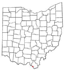
 Location of Coal Grove, Ohio | |
 Location of Coal Grove in Lawrence County | |
| Coordinates: 38°30′10″N 82°38′38″W / 38.50278°N 82.64389°W | |
| Country | United States |
| State | Ohio |
| County | Lawrence |
| Townships | Upper, Perry |
| Area | |
| • Total | 2.04 sq mi (5.28 km2) |
| • Land | 1.91 sq mi (4.94 km2) |
| • Water | 0.13 sq mi (0.35 km2) |
| Elevation | 600 ft (200 m) |
| Population (2020) | |
| • Total | 1,889 |
| • Estimate (2023)[3] | 1,827 |
| • Density | 991.08/sq mi (382.59/km2) |
| Time zone | UTC-5 (Eastern (EST)) |
| • Summer (DST) | UTC-4 (EDT) |
| ZIP code | 45638 |
| Area code | 740 |
| FIPS code | 39-16378[4] |
| GNIS feature ID | 2398587[2] |
Coal Grove is a village in Lawrence County, Ohio, United States, along the Ohio River. The population was 1,889 at the 2020 census. It borders the city of Ironton and lies across the Ohio River from Ashland, Kentucky. It is linked to Ashland by the Ben Williamson Memorial Bridge and Simeon Willis Memorial Bridge.
Coal Grove is a part of the Huntington-Ashland, WV-KY-OH, Metropolitan Statistical Area (MSA).
- ^ "ArcGIS REST Services Directory". United States Census Bureau. Retrieved September 20, 2022.
- ^ a b U.S. Geological Survey Geographic Names Information System: Coal Grove, Ohio
- ^ "Annual Estimates of the Resident Population for Incorporated Places in Ohio: April 1, 2020 to July 1, 2023". United States Census Bureau. Retrieved June 12, 2024.
- ^ "U.S. Census website". United States Census Bureau. Retrieved January 31, 2008.