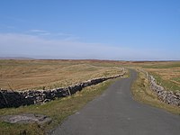
| Coal Road | |
|---|---|
 The Coal Road, looking north | |
| Route information | |
| Length | 4 mi[1] (6.4 km) |
| Existed | 12th century[1]–present |
| Major junctions | |
| North end | Garsdale |
| South end | Dent |
| Location | |
| Country | United Kingdom |
| Constituent country | England |
| Counties | Cumbria, |
| Road network | |
The Coal Road (also known as the Galloway Gate Road) is an unclassified highway which connects the railway stations at Garsdale and Dent in Cumbria, England. The road is within the Yorkshire Dales National Park, and was historically part of the West Riding of Yorkshire.[note 1] The name derives from its use transporting locally mined coal, although before that it was used as a droving route between England and Scotland through Mallerstang.
- ^ a b Lennie 2005, p. 82.
- ^ Chrystal, Paul (2017). The Place Names of Yorkshire; Cities, Towns, Villages, Rivers and Dales, some Pubs too, in Praise of Yorkshire Ales (1 ed.). Catrine: Stenlake. p. 103. ISBN 9781840337532.
Cite error: There are <ref group=note> tags on this page, but the references will not show without a {{reflist|group=note}} template (see the help page).