| Col d'Aubisque | |
|---|---|
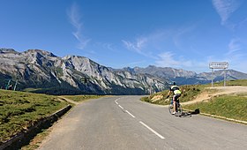
 The Col d'Aubisque, on the road towards Gourette and the Ossau Valley | |
| Elevation | 1,709 m (5,607 ft)[1] |
| Traversed by | D918 |
| Location | Pyrénées-Atlantiques, France |
| Range | Pyrenees |
| Coordinates | 42°58′36″N 0°20′23″W / 42.97667°N 0.33972°W |
The Col d'Aubisque (Occitan: Còth d'Aubisca) (elevation 1,709 m (5,607 ft)) is a mountain pass in the Pyrenees 30 km (19 mi) south of Tarbes and Pau in the department of the Pyrénées-Atlantiques, in the Aquitaine region of France.[2]
The pass is on the northern slopes of the Pic de Ger (2,613 m (8,573 ft)) and connects Laruns, in the valley of the Gave d'Ossau, via Eaux-Bonnes (west) to Argelès-Gazost, in the valley of the Gave de Pau, via the Col du Soulor (east). The road crosses the Cirque du Litor, in the upper part of the Ouzom valley. It is generally closed from December to June.
The pass is starting point of excursions and a centre for winter sports. In summer, it is popular with cyclists. It is regularly part of the Tour de France, generally rated an hors catégorie climb.
