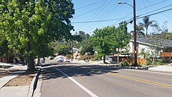
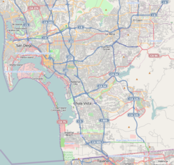
College Area, San Diego | |
|---|---|
| College Area | |
 Campanile Drive | |
| Coordinates: 32°46′19″N 117°04′08″W / 32.771831°N 117.068939°W | |
| Country | |
| State | |
| County | |
| City | |
The College Area is a residential community in the Mid-City region of San Diego, California, United States. It is dominated by San Diego State University (SDSU), after which the area is named. Several neighborhoods in the College Area were developed in the 1930s, with others becoming established in the post-war period.[1]
The College Area is bordered to the west by Kensington and Talmadge and to the east by the city of La Mesa. It includes the neighborhoods of the Catoctin Area, Dennstedt Point, East Falls View Drive, Saranac-Mohawk, and an Orthodox Jewish neighborhood near Congregation Beth Jacob Orthodox Synagogue.
El Cajon Boulevard is a busy shopping district; additional retail establishments are at South Campus Plaza, a university housing and commercial complex on College Avenue. The region includes East Campus Medical Center at UC San Diego Health, a 306-bed acute care facility, and the College-Rolando branch of the San Diego Public Library.
- ^ “Historical Neighborhoods.” College Neighborhoods, 2013. http://collegeneighborhoods.com/history/baja.html.
