Columbus, New Mexico | |
|---|---|
 View of Columbus from Pancho Villa State Park | |
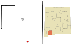
 Location of Columbus, New Mexico | |
| Coordinates: 31°49′32″N 107°38′03″W / 31.82556°N 107.63417°W | |
| Country | United States |
| State | New Mexico |
| County | Luna |
| Founded | 1891 |
| Government | |
| • Mayor | Esequiel Salas |
| Area | |
| • Total | 4.67 sq mi (12.09 km2) |
| • Land | 4.67 sq mi (12.09 km2) |
| • Water | 0.00 sq mi (0.00 km2) |
| Elevation | 4,072 ft (1,241 m) |
| Population | |
| • Total | 1,442 |
| • Density | 309.04/sq mi (119.32/km2) |
| Time zone | UTC-7 (Mountain (MST)) |
| • Summer (DST) | UTC-6 (MDT) |
| ZIP code | 88029 |
| Area code | 575 |
| FIPS code | 35-17050 |
| GNIS feature ID | 2413542[2] |
| Website | www |
Columbus is an incorporated village in Luna County, New Mexico, United States, about 3 miles (5 km) north of the Mexican border. It is considered a place of historical interest, as the scene of a 1916 attack by Mexican general Francisco "Pancho" Villa that caused the United States to send 10,000 troops there in the Mexican Expedition (originally referred to as the "punitive Mexican Expedition"). Columbus's population was 1,664 at the 2010 census.[4]
- ^ "ArcGIS REST Services Directory". United States Census Bureau. Retrieved October 12, 2022.
- ^ a b U.S. Geological Survey Geographic Names Information System: Columbus, New Mexico
- ^ Cite error: The named reference
USCensusDecennial2020CenPopScriptOnlywas invoked but never defined (see the help page). - ^ "Total Population: 2010 Census DEC Summary File 1 (P1), Columbus village, New Mexico". data.census.gov. U.S. Census Bureau. Retrieved May 26, 2020.
