Columbus Municipal Airport | |||||||||||||||
|---|---|---|---|---|---|---|---|---|---|---|---|---|---|---|---|
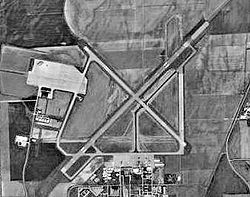
 USGS photo - 7 Aug 1997 | |||||||||||||||
 FAA diagram | |||||||||||||||
| Summary | |||||||||||||||
| Airport type | Public | ||||||||||||||
| Owner | City of Columbus | ||||||||||||||
| Location | Columbus, Indiana | ||||||||||||||
| Elevation AMSL | 656 ft / 200 m | ||||||||||||||
| Coordinates | 39°15′43″N 085°53′47″W / 39.26194°N 85.89639°W | ||||||||||||||
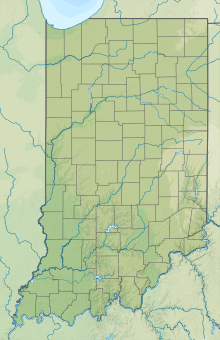
| Map | |||||||||||||||
 | |||||||||||||||
| Runways | |||||||||||||||
| |||||||||||||||
| Statistics | |||||||||||||||
| |||||||||||||||
- For the military use of this facility, see Bakalar Air Force Base.
Columbus Municipal Airport (IATA: CLU, ICAO: KBAK, FAA LID: BAK) is three miles north of Columbus, in Bartholomew County, Indiana, United States.[1]
Most U.S. airports use the same three-letter location identifier for the FAA and IATA, but this airport is BAK to the FAA and CLU to the IATA.[2]

- ^ a b FAA Airport Form 5010 for BAK PDF, effective 2009-05-07.
- ^ "CLU - Columbus [Muni], IN, US - Airport - Great Circle Mapper". gc.kls2.com.

