| Colville River | |
|---|---|
 Inupiat family on Colville River, 1901 | |
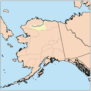
 Colville River course and drainage basin in northern Alaska. | |
| Location | |
| Country | United States |
| State | Alaska |
| Borough | North Slope |
| Physical characteristics | |
| Source | Confluence of Thunder and Storm creeks |
| • location | North slope of the De Long Mountains |
| • coordinates | 68°49′01″N 160°21′14″W / 68.81694°N 160.35389°W[1] |
| • elevation | 2,017 ft (615 m)[2] |
| Mouth | Harrison Bay, Beaufort Sea, Arctic Ocean |
• location | Northeast of Nuiqsut |
• coordinates | 70°26′46″N 150°21′28″W / 70.44611°N 150.35778°W[1] |
• elevation | 0 ft (0 m)[1] |
| Length | 350 mi (560 km)[1] |
| Basin size | 20,500 sq mi (53,000 km2)[3] |
| Discharge | |
| • location | Umiat, Alaska |
| • average | 10,192 cu ft/s (288.6 m3/s)[4] |
| • maximum | 268,000 cu ft/s (7,600 m3/s)[5] |
The Colville River (/ˈkoʊlvɪl/;[6] Inupiat: Kuukpik) is a major river of the Arctic Ocean coast of Alaska in the United States, approximately 350 miles (560 km) long.[1] One of the northernmost major rivers in North America, it drains a remote area of tundra on the north side of the Brooks Range entirely above the Arctic Circle in the southwestern corner of the National Petroleum Reserve-Alaska. The river is frozen for more than half the year and floods each spring.The Colville River and its adjacent hills are home to a variety of Arctic wildlife, including Lake Teshekpuk and Central Arctic caribou herds, and hawks.
As of March 2023, the Department of Interior permitted ConocoPhillips to build a new ice road from Kuparuk River Oil Field drill site and use a partially grounded ice bridge across the Colville River near Ocean Point "to transport sealift modules" to its Willow project oil drilling area.
- ^ a b c d e "Colville River". Geographic Names Information System. United States Geological Survey. January 1, 2000. Retrieved September 13, 2013.
- ^ Derived by entering source coordinates in Google Earth.
- ^ Walker, H. Jesse; Hadden, Lynn (1998). "Placing Colville River Delta Research on the Internet in a Digital Library Format" (PDF). University of Alaska Fairbanks. Archived from the original (PDF) on December 10, 2013. Retrieved September 13, 2013.
- ^ "USGS Surface-Water Annual Statistics for the Nation".
- ^ "Peak Streamflow for Alaska".
- ^ Wells, John C. (2008). Longman Pronunciation Dictionary (3rd ed.). Longman. ISBN 978-1-4058-8118-0.