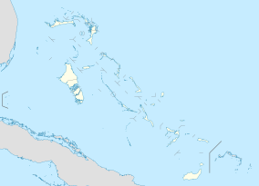
| Conception Island National Park | |
|---|---|
 Conception Island, Bahamas | |
| Location | Conception Island, the Bahamas |
| Coordinates | 23°29′N 75°03′W / 23.48°N 75.05°W[1] |
| Area | 30,000 acres (12,141 ha)[2] |
| Established | 1964 |
| Governing body | Bahamas National Trust |
| bnt | |
The Conception Island National Park is a protected area in the Bahamas. The island lies between Cat Island to the north and Rum Cay to the south. The vegetation consists of mangrove communities, with typical strand vegetation, and the island is visited by green turtles, sea birds and migrating birds.
- ^ "Conception Island National Park in Bahamas". Protected Planet. Archived from the original on 3 January 2019. Retrieved 3 January 2019.
- ^ "Conception Island National Park". Bahamas National Trust. Archived from the original on 27 April 2019. Retrieved 3 January 2019.
