Copparo | |
|---|---|
| Comune di Copparo | |
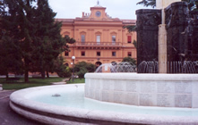
 Piazza del Popolo | |
| Coordinates: 44°54′N 11°50′E / 44.900°N 11.833°E | |
| Country | Italy |
| Region | Emilia-Romagna |
| Province | Ferrara (FE) |
| Frazioni | Ambrogio, Brazzolo, Coccanile-Cesta, Fossalta, Gradizza, Sabbioncello San Pietro, Sabbioncello San Vittore, Saletta - Cà Matte, Sant'Apollinare, Tamara, Ponte San Pietro |
| Government | |
| • Mayor | Fabrizio Pagnoni |
| Area | |
| • Total | 157 km2 (61 sq mi) |
| Elevation | 7 m (23 ft) |
| Population (1 January 2019)[2] | |
| • Total | 16,234 |
| • Density | 100/km2 (270/sq mi) |
| Demonym | Copparesi |
| Time zone | UTC+1 (CET) |
| • Summer (DST) | UTC+2 (CEST) |
| Postal code | 44034 |
| Dialing code | 0532 |
| Patron saint | St. Peter and St. Paul |
| Saint day | 29 June |
| Website | Official website |
Copparo (Ferrarese: Cupar, IPA: [kuˈpaːr]) is a town and comune of Emilia Romagna, Italy, in the Province of Ferrara, located 50 kilometres (31 mi) northeast of the regional capital of Bologna and 17 kilometres (11 mi) east of the provincial capital of Ferrara, Copparo sits in the fertile Po River Delta—10 kilometres (6 mi) south of the river and 35 kilometres (22 mi) from the Adriatic coast. The territory of the municipality lies between 0 and 7 metres (0 and 23 ft) above sea level.
- ^ "Superficie di Comuni Province e Regioni italiane al 9 ottobre 2011". Italian National Institute of Statistics. Retrieved 16 March 2019.
- ^ "Popolazione Residente al 1° Gennaio 2018". Italian National Institute of Statistics. Retrieved 16 March 2019.


