Coronie | |
|---|---|
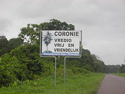
 Translation of the sign: Coronie: peaceful, free and friendly | |
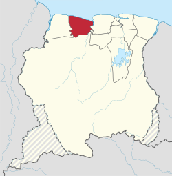
 Map of Suriname showing Coronie district | |
| Coordinates: 5°46′N 56°17′W / 5.767°N 56.283°W | |
| Country | Suriname |
| Established | 1851 |
| Capital | Totness |
| Area | |
| • Total | 3,902 km2 (1,507 sq mi) |
| Population (2012 census)[1] | |
| • Total | 3,391 |
| • Density | 0.87/km2 (2.3/sq mi) |
| Time zone | UTC-3 |
Coronie is a district of Suriname, situated on the coast. Coronie's capital city is Totness. The district border the Atlantic Ocean to the north, the Surinamese district of Saramacca to the east, the Surinamese district of Sipaliwini to the south and the Surinamese district of Nickerie to the west. The district is served by the Totness Airstrip.
The district has a population of 3,391 and an area of 3,902 km2, making it the least-populated district of Suriname.[1]
- ^ a b "Resorts in Suriname Census 2012" (PDF). Retrieved 26 May 2020.