| Council Grove Lake | |
|---|---|
 | |
 | |
| Location | Morris County, Kansas |
| Coordinates | 38°41′59″N 96°31′10″W / 38.69972°N 96.51944°W |
| Type | Reservoir |
| Primary inflows | Munkers Creek, Neosho River |
| Primary outflows | Neosho River |
| Catchment area | 245 sq mi (630 km2) |
| Basin countries | United States |
| Managing agency | U.S. Army Corps of Engineers |
| Built | June 1960 |
| First flooded | October 9, 1964 |
| Surface area | 3,235 acres (13.09 km2)[1] |
| Max. depth | 56 ft (17 m)[2] |
| Water volume | Full: 43,984 acre⋅ft (54,253,000 m3) Current (Jan. 2016): 44,443 acre⋅ft (54,820,000 m3)[3] |
| Shore length1 | 40 mi (64 km) |
| Surface elevation | Full: 1,274 ft (388 m) Current (Jan. 2016): 1,274 ft (388 m)[3] |
| Settlements | Council Grove |
| References | [4] |
| 1 Shore length is not a well-defined measure. | |
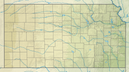
Council Grove Lake is a reservoir on the Neosho River in east-central Kansas.[4] Built and managed by the U.S. Army Corps of Engineers, it is used for flood control, recreation, and water supply.[1]
- ^ a b "Pertinent Data". U.S. Army Corps of Engineers. Retrieved 2016-01-15.
- ^ "Council Grove Reservoir Fishing Information". Kansas Wildlife, Parks and Tourism. Retrieved 2016-01-14.
- ^ a b "CNGK1 : Council Grove Lake". U.S. Army Corps of Engineers. Retrieved 2016-01-14.
- ^ a b "Council Grove Lake". Geographic Names Information System. United States Geological Survey, United States Department of the Interior. Retrieved 2016-01-14.

