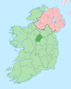
County Longford
Contae an Longfoirt | |
|---|---|
| Motto(s): | |
 | |
| Country | Ireland |
| Province | Leinster |
| Region | Eastern and Midland |
| Established | 1570[1] |
| County town | Longford |
| Government | |
| • Local authority | Longford County Council |
| • Dáil constituency | Longford–Westmeath |
| • EP constituency | Midlands–North-West |
| Area | |
| • Total | 1,091 km2 (421 sq mi) |
| • Rank | 29th |
| Highest elevation | 278 m (912 ft) |
| Population | |
| • Total | 46,751 |
| • Rank | 31st |
| • Density | 43/km2 (110/sq mi) |
| Time zone | UTC±0 (WET) |
| • Summer (DST) | UTC+1 (IST) |
| Eircode routing keys | N39 (primarily) |
| Telephone area codes | 043 (primarily) |
| ISO 3166 code | IE-LD |
| Vehicle index mark code | LD |
| Website | Official website |
 | |
County Longford (Irish: Contae an Longfoirt) is a county in Ireland. It is in the province of Leinster. It is named after the town of Longford. Longford County Council is the local authority for the county. The population of the county was 46,634 at the 2022 census.[2] The county is based on the historic Gaelic territory of Annaly (Anghaile), formerly known as Teffia (Teathbha).[3]
- ^ "'Geographical loyalty'? Counties, palatinates, boroughs and ridings". 6 March 2013. Archived from the original on 23 June 2019. Retrieved 23 June 2019.
- ^ a b "Census of Population 2022 – Preliminary Results". Central Statistics Office (Ireland). 23 June 2022. Retrieved 23 May 2023.
- ^ Dr. Kieran O’Conor and Dr. Paul Naessens. "Non-invasive investigation of Anglo-Norman castle sites in County Longford" Archived 15 November 2017 at the Wayback Machine. Galway University, 2012. pp.6–7
