| Cowes Victoria | |||||||||
|---|---|---|---|---|---|---|---|---|---|
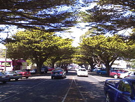
 Golden Cypress trees on Thompson Avenue | |||||||||
| Coordinates | 38°27′04″S 145°14′31″E / 38.45111°S 145.24194°E | ||||||||
| Population | 6,593 (2021 census)[1] | ||||||||
| • Density | 318.5/km2 (824.9/sq mi) | ||||||||
| Established | 1869 | ||||||||
| Postcode(s) | 3922 | ||||||||
| Elevation | 12 m (39 ft)[2] | ||||||||
| Area | 20.7 km2 (8.0 sq mi) | ||||||||
| Location | 141 km (88 mi) S of Melbourne CBD | ||||||||
| LGA(s) | Bass Coast Shire | ||||||||
| County | Mornington | ||||||||
| State electorate(s) | Bass | ||||||||
| Federal division(s) | Monash | ||||||||
| |||||||||
Cowes is the main township on Phillip Island in the Gippsland region of Victoria, Australia. It is about two hours' drive from Melbourne and can also be reached by coach, or passenger ferry from Stony Point on the Mornington Peninsula.[3] Cowes is located on the northern side of Phillip Island and faces towards French Island and the Mornington Peninsula. At the 2021 census, Cowes had a population of 6,593.[1]
- ^ a b "2016 Census QuickStats Cowes". Australian Bureau of Statistics. Retrieved 2 March 2019.
- ^ a b c d "Cowes Climate Statistics (1882-1978)". Bureau of Meteorology. Retrieved 21 September 2024.
- ^ "Getting here | Categories | Phillip Island". www.visitphillipisland.com. Retrieved 11 September 2018.
