| Cropredy | |
|---|---|
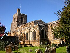
 St Mary the Virgin parish church | |
Location within Oxfordshire | |
| Area | 9.42 km2 (3.64 sq mi) |
| Population | 717 (Both area and population include the civil parish of Prescote in the 2011 Census for reasons of confidentiality of the latter being officially deemed too small to make up its own Output Area.) |
| • Density | 76/km2 (200/sq mi) |
| OS grid reference | SP4646 |
| • London | 82 miles (132 km) |
| Civil parish |
|
| District | |
| Shire county | |
| Region | |
| Country | England |
| Sovereign state | United Kingdom |
| Post town | Banbury |
| Postcode district | OX17 |
| Dialling code | 01295 |
| Police | Thames Valley |
| Fire | Oxfordshire |
| Ambulance | South Central |
| UK Parliament | |
| Website | Cropredy village website |
Cropredy (/ˈkrɒprədi/ KROP-rə-dee) is a village and civil parish on the River Cherwell, 4 miles (6.4 km) north of Banbury in Oxfordshire.[1]
- ^ "Area: Cropredy (Parish): Key Figures for 2011 Census: Key Statistics". Neighbourhood Statistics. Office for National Statistics. Retrieved 3 September 2015.
