Crownpoint, New Mexico | |
|---|---|
 Crownpoint Post Office | |
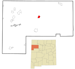
 Location of Crownpoint, New Mexico | |
| Coordinates: 35°43′02″N 108°08′35″W / 35.71722°N 108.14306°W | |
| Country | United States |
| State | New Mexico |
| County | McKinley |
| Area | |
| • Total | 67.51 sq mi (174.85 km2) |
| • Land | 67.51 sq mi (174.84 km2) |
| • Water | 0.00 sq mi (0.01 km2) |
| Elevation | 6,851 ft (2,088 m) |
| Population | |
| • Total | 2,900 |
| • Density | 42.96/sq mi (16.59/km2) |
| Time zone | UTC-7 (Mountain (MST)) |
| • Summer (DST) | UTC-6 (MDT) |
| ZIP code | 87313 |
| Area code | 505 |
| FIPS code | 35-18940 |
| GNIS feature ID | 2407689[2] |
Crownpoint (Navajo: Tʼiistsʼóóz Ńdeeshgizh) is a census-designated place (CDP) on the Navajo Nation in McKinley County, New Mexico. The population was 2,500 at the time of the 2010 census.[4] It is located along the Trails of the Ancients Byway, one of the designated New Mexico Scenic Byways.[5]
- ^ "ArcGIS REST Services Directory". United States Census Bureau. Retrieved October 12, 2022.
- ^ a b U.S. Geological Survey Geographic Names Information System: Crownpoint, New Mexico
- ^ Cite error: The named reference
USCensusDecennial2020CenPopScriptOnlywas invoked but never defined (see the help page). - ^ "2010 Census Gazetteer Files - Places: New Mexico". United States Census Bureau. Retrieved October 20, 2017.
- ^ Trail of the Ancients. Archived August 21, 2014, at the Wayback Machine New Mexico Tourism Department. Retrieved August 14, 2014.
