| Crundale | |
|---|---|
 | |
Location within Kent | |
| Area | 6.39 km2 (2.47 sq mi) |
| Population | 186 (Civil Parish 2011)[1] |
| • Density | 29/km2 (75/sq mi) |
| OS grid reference | TR076493 |
| Civil parish |
|
| District | |
| Shire county | |
| Region | |
| Country | England |
| Sovereign state | United Kingdom |
| Post town | CANTERBURY |
| Postcode district | CT4 |
| Dialling code | 01227 |
| Police | Kent |
| Fire | Kent |
| Ambulance | South East Coast |
| UK Parliament | |
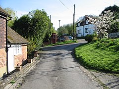
Crundale is a mostly rural village and civil parish in the Ashford District of Kent in southeast England. The village covers a section of one of the dual escarpments of the North Downs at this point, about halfway between Ashford and Canterbury.
