Cuajinicuilapa | |
|---|---|
Town | |
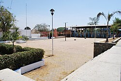
 Main plaza of Cuajinicuilapa | |
| Coordinates: 16°28′18″N 98°24′55″W / 16.47167°N 98.41528°W | |
| Country | |
| State | Guerrero |
| Government | |
| • Municipal President | C. José Guadalupe Salvador Cruz Castro |
| Area | |
| • Total | 715 km2 (276 sq mi) |
| Elevation (of seat) | 50 m (160 ft) |
| Population (2020) Municipality | |
| • Total | 26,627 |
| • Seat | 10,282 |
| Time zone | UTC-6 (Central (US Central)) |
| Postal code (of seat) | 41919 |
| Area code | 741 |
| Demonym | Cuijileña |
| Website | [1] (in Spanish) |
Cuajinicuilapa is the head town of the municipality of the same name in the Costa Chica region of the Mexican state of Guerrero. A low-lying area, it borders the Pacific Ocean and the state of Oaxaca. The municipality has the state's largest population of Afro-Mexicans with most of the population of this ethnicity. The town and municipality are highly socioeconomically marginalized and it is the poorest municipality of the state, with the economy dependent on livestock and fishing.


