Culemborg | |
|---|---|
City and municipality | |
 Culemborg market square | |
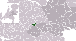
 Location in Gelderland | |
| Coordinates: 51°57′13″N 5°13′34″E / 51.95361°N 5.22611°E | |
| Country | Netherlands |
| Province | Gelderland |
| Government | |
| • Body | Municipal council |
| • Mayor | Gerdo van Grootheest (GL) |
| Area | |
| • Total | 31.14 km2 (12.02 sq mi) |
| • Land | 29.29 km2 (11.31 sq mi) |
| • Water | 1.85 km2 (0.71 sq mi) |
| Elevation | 5 m (16 ft) |
| Population (January 2021)[4] | |
| • Total | 29,121 |
| • Density | 994/km2 (2,570/sq mi) |
| Demonym(s) | Culemborger, Blauwlap |
| Time zone | UTC+1 (CET) |
| • Summer (DST) | UTC+2 (CEST) |
| Postcode | 4100–4107 |
| Area code | 0345 |
| Website | www |
Culemborg (Dutch pronunciation: [ˈkyləmbɔr(ə)x] ) is a municipality and a city in the centre of the Netherlands, in the province of Gelderland. The city had a population of 29,386 on 1 January 2022 and is situated just south of the Lek river. Direct train lines run from the railway station towards the cities of Utrecht and Den Bosch, via the near railway bridge.
- ^ "Burgemeester Van Schelven" [Mayor Van Schelven] (in Dutch). Gemeente Culemborg. Archived from the original on 14 July 2014. Retrieved 23 June 2014.
- ^ "Kerncijfers wijken en buurten 2020" [Key figures for neighbourhoods 2020]. StatLine (in Dutch). CBS. 24 July 2020. Retrieved 19 September 2020.
- ^ "Postcodetool for 4101BK". Actueel Hoogtebestand Nederland (in Dutch). Het Waterschapshuis. Retrieved 23 June 2014.
- ^ "Bevolkingsontwikkeling; regio per maand" [Population growth; regions per month]. CBS Statline (in Dutch). CBS. 1 January 2021. Retrieved 2 January 2022.

