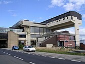
Cumbernauld
| |
|---|---|
| Town | |
Location within North Lanarkshire | |
| Area | 21.5 km2 (8.3 sq mi) [1] |
| Population | 50,530 (2022)[2] |
| • Density | 2,350/km2 (6,100/sq mi) |
| OS grid reference | NS763736 |
| • Edinburgh | 31 mi (50 km) |
| • London | 345 mi (555 km) |
| Council area | |
| Lieutenancy area | |
| Country | Scotland |
| Sovereign state | United Kingdom |
| Post town | GLASGOW |
| Postcode district | G67, G68 |
| Dialling code | 01236 |
| Police | Scotland |
| Fire | Scottish |
| Ambulance | Scottish |
| UK Parliament | |
| Scottish Parliament | |
Cumbernauld (/ˌkʌmbərˈnɔːld/;[3] Scottish Gaelic: Comar nan Allt[4]) is a large town in the historic county of Dunbartonshire and council area of North Lanarkshire, Scotland. It is the tenth most-populous locality in Scotland and the most populated town in North Lanarkshire, positioned in the centre of Scotland's Central Belt. Geographically, Cumbernauld sits between east and west, being on the Scottish watershed between the Forth and the Clyde; however, it is culturally more weighted towards Glasgow and the New Town's planners aimed to fill 80% of its houses from Scotland's largest city to reduce housing pressure there.[5]
Traces of Roman occupation are still visible, for example at Westerwood and, less conspicuously, north of the M80 where the legionaries surfaced the Via Flavii, later called the "Auld Cley Road". This is acknowledged in Cumbernauld Community Park, also site of Scotland's only visible open-air Roman altar,[6] in the shadow of the imposing Carrickstone Water Tower.
For many years Cumbernauld was chiefly populated around what is now called The Village with the medieval castle a short walk away surrounded by its own park grounds. The castle frequently hosted visiting royalty and the grounds were famous for their white cattle which were hunted in the oak forest. The town began to enlarge as the weaving industry of the village was supplemented by mining and quarrying as travel across Scotland became easier due to the Forth and Clyde Canal and the railways being constructed. Cumbernauld railway station, though some distance from the village, improved communications with Glasgow, Falkirk and Stirling.
Cumbernauld was designated as the site for a New Town on 9 December 1955. This led to rapid expansion and building for about 40 years until the town became established as the largest in North Lanarkshire. At the UK census in 2011, the population of Cumbernauld was approximately 52,000, housed in more than a dozen residential areas. Cumbernauld's economy is a mixture of some manufacturing, mainly on its industrial estates, as well as service industries in the town centre and in sites close to the M80.
Cumbernauld was featured in Our World, the first live multinational multi-satellite television production.
- ^ "Cumbernauld (North Lanarkshire, Scotland, United Kingdom) – Population Statistics, Charts, Map, Location, Weather and Web Information". citypopulation.de. Retrieved 18 April 2019.
- ^ "Mid-2020 Population Estimates for Settlements and Localities in Scotland". National Records of Scotland. 31 March 2022. Retrieved 31 March 2022.
- ^ http://theses.gla.ac.uk/5270/1/2014DrummondPhD.pdf#233 Peter Drummond PhD 2004 pg 233
- ^ "Ainmean-Àite na h-Alba – Gaelic Place-Names of Scotland – Database". Gaelicplacenames.org. Archived from the original on 3 October 2019. Retrieved 30 October 2011.
- ^ Osborn, Frederic James; Whittick, Arnold (1963). The New towns – The Answer to Megalopolis. London: McGraw-Hill. pp. 312–321. Retrieved 25 October 2017.
- ^ Brown, James (22 May 2011), Via Flavii Roman Altar Carrickstone, retrieved 4 January 2022


