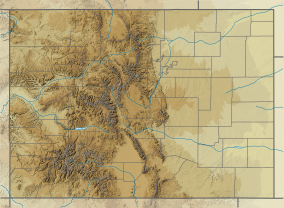
| Curecanti National Recreation Area | |
|---|---|
 The Dillon Pinnacles in Curecanti NRA. | |
| Location | Gunnison and Montrose counties, Colorado, United States |
| Nearest city | Gunnison, CO |
| Coordinates | 38°27′17″N 107°19′37″W / 38.45472°N 107.32694°W |
| Area | 43,095 acres (174.40 km2)[1] |
| Established | February 6, 1965 |
| Visitors | 924,468 (in 2011)[2] |
| Governing body | National Park Service |
| Website | Curecanti National Recreation Area |
Curecanti National Recreation Area (Pronounced /kɜːrɪˈkɑːntiː/ (locally) or /kuːrɪˈkɑːntiː/.[3]) is a National Park Service unit located on the Gunnison River in western Colorado. Established in 1965, Curecanti National Recreation Area is responsible for developing and managing recreational facilities on three reservoirs, Blue Mesa Reservoir, Morrow Point Reservoir and Crystal Reservoir, constructed on the upper Gunnison River in the 1960s by the U.S. Bureau of Reclamation to better utilize the vital waters of the Colorado River and its major tributaries. A popular destination for boating and fishing, Curecanti offers visitors two marinas, traditional and group campgrounds, hiking trails, boat launches, and boat-in campsites. The state's premiere lake trout and Kokanee salmon fisheries, Curecanti is a popular destination for boating and fishing, and is also a popular area for ice-fishing in the winter months.
- ^ "Listing of acreage – December 31, 2011" (XLSX). Land Resource Division, National Park Service. Retrieved 2012-12-26. (National Park Service Acreage Reports)
- ^ "NPS Annual Recreation Visits Report". National Park Service. Retrieved 2012-12-26.
- ^ Benson, Maxine (1994). 1001 Colorado Place Names. Lawrence: University Press of Kansas. ISBN 0-7006-0632-7.

