Curvelo | |
|---|---|
| Municipality of Curvelo | |
| Nickname: Hinterland gate | |
| Motto: "O temor do senhor é o princípio da sabedoria" | |
 Location of Curvelo in the state of Minas Gerais | |
| Coordinates: 18°45′21″S 44°25′51″W / 18.75583°S 44.43083°W | |
| Country | |
| Region | Southeast |
| State | |
| Government | |
| • Prefeito | Luiz Paulo (PP) |
| Area | |
| • Total | 3,295.894 km2 (1,272.552 sq mi) |
| Elevation | 672 m (2,205 ft) |
| Population (2020 [1]) | |
| • Total | 80,616 |
| Time zone | UTC−3 (BRT) |
| HDI (2010) | 0.713 – high[2] |
| Website | www |
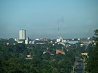
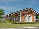
Curvelo is a municipality in the state of Minas Gerais, Brazil. It is located in the geodesic centre of Minas Gerais, 170 km north of the capital, Belo Horizonte, and connected to the capital by highways MG 135 and BR 040. Its estimated population is 80,616 inhabitants (2020) and the total area of the municipality is 3,344 kmª. The city lies at an altitude of 633 metres. Curvelo takes its name from the Brazil-born Portuguese priest Antônio Corvelo de Ávila,[3] when the parish of Santo Antônio da Estrada e o Padre Antônio de Ávila Curvelo was founded in the 18th century (on 16 March 1720).[4]
- ^ IBGE 2020
- ^ "Archived copy" (PDF). United Nations Development Programme (UNDP). Archived from the original (PDF) on July 8, 2014. Retrieved August 1, 2013.
{{cite web}}: CS1 maint: archived copy as title (link) - ^ "História de Curvelo". site da Prefeitura Municipal de Curvelo (in Portuguese). Retrieved 13 August 2024.
- ^ "Conheça mais sobre Curvelo". 7diasnews.com.br (in Portuguese). 1 November 2023. Retrieved 13 August 2024.


