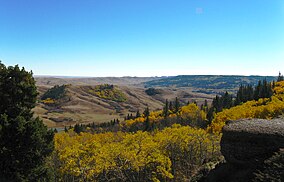
| Cypress Hills Interprovincial Park | |
|---|---|
 Cypress Hills | |
| Location | , Canada |
| Nearest city | Medicine Hat, AB; Swift Current, SK |
| Coordinates | 49°34′31″N 110°00′23″W / 49.57528°N 110.00639°W |
| Area | 400 km2 (150 sq mi) |
| Established | 1931 (Saskatchewan) 1951 (Alberta) 1989 (interprovincial) |
| Governing body | Alberta Environment and Parks and Ministry of Parks, Culture and Sport (Saskatchewan) |
 | |
Cypress Hills Interprovincial Park is a natural park in Canada straddling the Alberta / Saskatchewan boundary and jointly administered by the two provinces. Located south-east of Medicine Hat in the Cypress Hills, it became Canada's first interprovincial park in 1989.[1]
The park consists of two protected areas, the 345 km2 (133 sq mi) West Block, that straddles the Alberta / Saskatchewan boundary between Alberta Highway 41, the townsite of Elkwater, Saskatchewan Highway 615, Saskatchewan Highway 271, and Fort Walsh, and the Centre Block, an additional area of 58 km2 (22 sq mi) in Saskatchewan, west of Saskatchewan Highway 21.
- ^ "Provincial Parks". The Encyclopedia of Saskatchewan. University of Regina. Archived from the original on September 20, 2022. Retrieved September 20, 2022.
