 Cypress Island from Rosario Strait | |
 Cypress Island in the San Juan Islands | |
| Geography | |
|---|---|
| Location | Salish Sea |
| Coordinates | 48°34′27″N 122°42′20″W / 48.57417°N 122.70556°W |
| Area | 8.6 sq mi (22 km2) |
| Length | 4.75 mi (7.64 km) |
| Width | 3.5 mi (5.6 km) |
| Highest elevation | 1,525 ft (464.8 m) |
| Administration | |
United States | |
| State | Washington |
| County | Skagit County |
| Demographics | |
| Population | 40 (2000) |


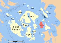
Cypress Island is the westernmost part of Skagit County, Washington, and is about halfway between the mainland and offshore San Juan County. It is separated from Blakely Island to the west by Rosario Strait and from Guemes Island to the east by Bellingham Channel. The island has a land area of 5,500 acres (22 km2), and a population of 40 persons as of the 2000 United States Census.
The Washington Department of Natural Resources manages about 5,100 acres (21 km2) of the island and leaves the island in a natural state. Cypress is heavily forested and has a system of trails linking various parts of the island. In roughly the middle of the island is a lake of about 7 acres (28,000 m2). On the southeastern corner of the island is a sheltered bay featuring a salmon fish farm. Cypress is not served by ferry and there are no public utilities on the island.
The island is a popular destination for kayak trips due its relatively close proximity to the mainland and to the camping available at two sites on the east side.
Sheltered anchorages for boaters can be found in Eagle Harbor with public state park facilities.