Native name: Rangitoto ki te Tonga (Māori) | |
|---|---|
 D'Urville Island and Tasman Bay | |
 Location of D'Urville Island | |
| Geography | |
| Coordinates | 40°50′S 173°52′E / 40.833°S 173.867°E |
| Area | 150 km2 (58 sq mi) |
| Highest elevation | 729 m (2392 ft)[1] |
| Highest point | Attempt Hill[2] |
| Administration | |
| Region | Marlborough District |
| Demographics | |
| Population | 52 |
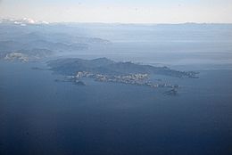
D'Urville Island (/dɜːrˈvɪl/), Māori name Rangitoto ki te Tonga, is the largest island in the Marlborough Sounds, on the northern coast of the South Island of New Zealand. It was named after the French explorer Jules Dumont d'Urville. With an area of approximately 150 square kilometres (58 sq mi), it is the eighth-largest island of New Zealand, and has around 52 permanent residents.[3] The local authority is the Marlborough District Council.
- ^ "Attempt Hill, Marlborough – NZ Topo Map". Land Information New Zealand. Retrieved 17 October 2017.
- ^ Cite error: The named reference
teara_Westernwas invoked but never defined (see the help page). - ^ Gerard Hindmarsh (2006). "Discovering D'Urville". Heritage New Zealand. Archived from the original on 11 May 2011. Retrieved 13 January 2011.