Dale County | |
|---|---|
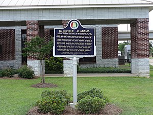
 Daleville historical marker | |
 Location within the U.S. state of Alabama | |
 Alabama's location within the U.S. | |
| Coordinates: 31°26′00″N 85°36′00″W / 31.4333°N 85.6°W | |
| Country | |
| State | |
| Founded | December 22, 1824 |
| Named for | Samuel Dale |
| Seat | Ozark |
| Largest city | Ozark |
| Area | |
| • Total | 563 sq mi (1,460 km2) |
| • Land | 561 sq mi (1,450 km2) |
| • Water | 1.6 sq mi (4 km2) 0.3% |
| Population (2020) | |
| • Total | 49,326 |
| • Estimate (2023) | 49,871 |
| • Density | 88/sq mi (34/km2) |
| Time zone | UTC−6 (Central) |
| • Summer (DST) | UTC−5 (CDT) |
| Congressional district | 2nd |
| Website | www |
| |
Dale County is a county located in the southeastern part of the U.S. state of Alabama. As of the 2020 census the population was 49,326.[1] Its county seat and largest city is Ozark.[2] Its name is in honor of General Samuel Dale.[3]
Dale County comprises the Ozark, AL Micropolitan Statistical Area, which is also included in the Dothan-Ozark, AL Combined Statistical Area. It was originally a part of Enterprise–Ozark micropolitan area before being split, and for a longer while was originally part of the Dothan-Enterprise-Ozark combined statistical area but Coffee County is now its own separate primary statistical area in later censuses.[4][5]
The vast majority of Fort Novosel (formerly Fort Rucker) is located in Dale County.
- ^ "State & County QuickFacts: Dale County, Alabama". U.S. Census Bureau. Retrieved September 13, 2023.
- ^ "Find a County". National Association of Counties. Archived from the original on May 31, 2011. Retrieved June 7, 2011.
- ^ Gannett, Henry (1905). The Origin of Certain Place Names in the United States. Government Printing Office. pp. 98.
- ^ "Dothan-Enterprise-Ozark, AL Combined Statistical Area" (PDF). United States Census Bureau. Retrieved December 14, 2021.
- ^ "OMB Bulletin No. 20-01: Revised Delineations of Metropolitan Statistical Areas, Micropolitan Statistical Areas, and Combined Statistical Areas, and Guidance on Uses of the Delineations of These Areas" (PDF). United States Office of Management and Budget. March 6, 2020. Retrieved September 21, 2020.
