Davanagere District | |
|---|---|
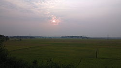
Clockwise from top-left: Bhimeshwara Temple at Nilagunda, Hills near Channagiri, Harihareshwara Temple at Harihar, Fields near Hadadi, Shanti Sagara | |
 Location in Karnataka | |
| Coordinates: 14°14′N 75°54′E / 14.23°N 75.9°E | |
| Country | |
| State | Karnataka |
| Formed | 15 August 1997 |
| Headquarters | Davanagere |
| Talukas | Davanagere Harihar Jagalur Honnali Channagiri Nyamati |
| Government | |
| • Deputy Commissioner | Dr. Venkatesh M.V (IAS) |
| Area | |
| • Total | 4,460 km2 (1,720 sq mi) |
| Population (2011) | |
| • Total | 1,643,494 |
| • Density | 370/km2 (950/sq mi) |
| Languages | |
| • Official | Kannada |
| Time zone | UTC+5:30 (IST) |
| PIN | 577001-006 |
| Telephone code | + 91 (08192 |
| Vehicle registration | KA-17 |
| Website | davanagere |
Davanagere district is an administrative district of Karnataka state in India. It is the centre of Karnataka. The city of Davanagere is the district headquarters. It had a population of 1,643,494 of which 32.31% was urban as of 2011. This district was separated from Chitradurga district in 1997 by the then Chief minister of Karnataka J. H. Patel including Chennagiri and Honali Taluks Shimoga district.
The district lies in the central plains of the state with its unique features of having an influence of the north and the south of the state. The prominent towns in this district are Harihara, Jagalur, Honnali Channagiri and Nyamati, these also happen to be its six other taluks. It is bound by Shimoga district and Haveri district on the west, Chitradurga district on the east, Vijayanagara district on the north, and Chikmagalur district on the south.
The Davanagere district has 6 taluks, 20 hoblis, 197 gram panchayats, 652 villages including Harakanahalu, 904 habitations, and 2 city municipal councils and one City Corporation.[1]
- ^ District formation Archived 3 March 2015 at the Wayback Machine The Official Website of Zilla Panchayat, Davangere, Government of Karnataka.


