| De Hoop Marine Protected Area | |
|---|---|
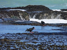
 African oystercatchers at De Hoop | |
 De Hoop MPA location | |
| Location | Western Cape, South Africa |
| Nearest city | Arniston |
| Coordinates | 34°30′S 20°45′E / 34.500°S 20.750°E |
| Area | 288.9 km2 |
| Established | 2000 |
The De Hoop Marine Protected Area lies between Arniston and the mouth of the Breede River on the south coast of South Africa adjacent to the De Hoop Nature Reserve. The MPA is 51 kilometres long, and extends 5 nautical miles to sea. The whole MPA is a restricted area (No Take zone) and is part of the migratory route and calving area for Southern right whales. The area protects habitats for several economically important inshore reef fish species, and ensures the retention of marine biomass in this part of the coast. The limestone coastline is includes archaeological sites and middens that date back centuries. The MPA is close to the Breede River estuary and, provides protection for species like cob (Argyrosomus spp.) that breed in the estuary and then return to the ocean.[1]
