Deal Island, Maryland | |
|---|---|
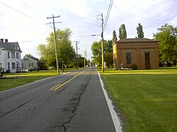
 The old bank
along MD 363 on Deal Island | |
 | |
| Coordinates: 38°9′16″N 75°56′44″W / 38.15444°N 75.94556°W | |
| Country | |
| State | |
| County | |
| Area | |
| • Total | 5.37 sq mi (13.91 km2) |
| • Land | 3.03 sq mi (7.85 km2) |
| • Water | 2.34 sq mi (6.05 km2) |
| Elevation | 3 ft (0.9 m) |
| Population (2020) | |
| • Total | 375 |
| • Density | 123.72/sq mi (47.77/km2) |
| Time zone | UTC−5 (Eastern (EST)) |
| • Summer (DST) | UTC−4 (EDT) |
| ZIP codes | 21821, 21870 |
| Area code | 410 |
| FIPS code | 24-22100 |
| GNIS feature ID | 0590074 |
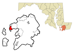
Deal Island is a census-designated place (CDP) in Somerset County, Maryland, United States. The population was 375[2] at the 2020 census. It is included in the Salisbury, Maryland-Delaware Metropolitan Statistical Area. The small town was listed on the National Register of Historic Places as the Deal Island Historic District in 2006.[3]
- ^ "2020 U.S. Gazetteer Files". United States Census Bureau. Retrieved April 26, 2022.
- ^ "Deal Island Demographics - Get Current Census Data for Deal Island, MD". www.maryland-demographics.com. Retrieved March 29, 2022.
- ^ "National Register Information System". National Register of Historic Places. National Park Service. April 15, 2008.