 Satellite image of the island by Sentinel-2 (March 2023) | |
| Geography | |
|---|---|
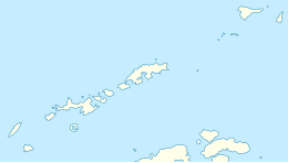
| Location | Antarctica |
| Coordinates | 62°57′30″S 60°38′30″W / 62.95833°S 60.64167°W |
| Area | 79 km2 (31 sq mi) |
| Length | 12 km (7.5 mi) |
| Width | 12 km (7.5 mi) |
| Highest elevation | 542 m (1778 ft) |
| Highest point | Mount Pond |
| Administration | |
| Administered under the Antarctic Treaty System | |
| Demographics | |
| Population | 0 |
| Surgidero Iquique Lighthouse | |
| Construction | concrete (foundation), fiberglass (tower) |
| Height | 4.5 m (15 ft) |
| Shape | cylinder |
| Markings | stripe (white, orange, horizontal direction) |
| Power source | solar power |
| Focal height | 114 m (374 ft) |
| Range | 5 nmi (9.3 km; 5.8 mi) |
| Characteristic | Fl W 5s |

Deception Island is in the South Shetland Islands close to the Antarctic Peninsula with a large and usually "safe" natural harbor, which is occasionally affected by the underlying active volcano.[1][better source needed] This island is the caldera of an active volcano, which seriously damaged local scientific stations in 1967 and 1969. The island previously held a whaling station. It is now a tourist destination with over 15,000 visitors per year.[citation needed] Two research stations are operated by Argentina and Spain during the summer season.[2] While various countries have asserted sovereignty, it is still administered under the Antarctic Treaty System.
- ^ Djajkovski, Petar (30 March 2017). "Deception Island: The "safest" harbor in Antarctica until it was abandoned in the 1960s". Abandoned Spaces.
- ^ Geyer, A.; Álvarez-Valero, A.M.; Gisbert, G.; Aulinas, M.; Hernández-Barreña, D.; Lobo, A.; Marti, J. (23 January 2019). "Deciphering the evolution of Deception Island's magmatic system". Scientific Reports. 9 (1): 373. Bibcode:2019NatSR...9..373G. doi:10.1038/s41598-018-36188-4. ISSN 2045-2322. PMC 6344569. PMID 30674998.

