| Deep Creek Valley | |
|---|---|
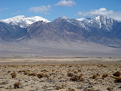
 View southeasterly across valley, west flank Deep Creek Mountains | |
| Length | 35 mi (56 km) N-S |
| Width | 4 mi (6.4 km) |
| Geography | |
| Country | United States |
| State | Utah |
| Regions | |
| Counties | |
| Communities | |
| Borders on | |
| Coordinates | 40°10′37″N 113°59′49″W / 40.1769°N 113.9969°W |
| Rivers |
|
Deep Creek Valley is a 35-mile (56 km) long[1] valley located in southwest Tooele County at the Utah-Nevada border; the extreme south of the valley is in northwest Juab County. The valley parallels the west flank of the Deep Creek Range, both north-trending. In the north-northeast, its outlet widens into the southwest of the Great Salt Lake Desert region.
The mountain range turns southwest and west in the south, and encloses the higher altitude terrain of the valley; here, the Goshute Indian Reservation lies in the mountains and the Deep Creek Valley's south; the community of Goshute is adjacent the valley; the reservation also extends westward into Nevada, into the east of the Antelope Valley.
- ^ Utah, DeLorme Atlas & Gazetteer, pp. 22-23, 30-31.
