Dehradun district | |
|---|---|
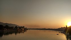
Clockwise from top: Ganga in Rishikesh, War memorial in Indian Military Academy, Valley near Nag Tibba, Bandarpunch from Lal Tibba, Mahasu Devta Temple in Hanol, Forest Research Institute | |
 Location in Uttarakhand | |
| Coordinates: 30°23′N 77°58′E / 30.38°N 77.97°E | |
| Country | |
| State | Uttarakhand |
| Division | Garhwal |
| Headquarters | Dehradun |
| Government | |
| • District Magistrate | Dr. R. Rajesh Kumar, IAS |
| • SSP | Janmaijai Prabhakar Kailash, IPS |
| Area | |
| • Total | 3,088 km2 (1,192 sq mi) |
| Population (2011) | |
| • Total | 1,696,694 |
| • Density | 550/km2 (1,400/sq mi) |
| Languages | |
| • Official | Hindi, Garhwali |
| • Native | Garhwali, Jaunsari |
| Time zone | UTC+5:30 (IST) |
| Vehicle registration | UK 07 |
| Website | dehradun |
Dehradun district () is a district in Garhwal which is a part of Uttarakhand state in northern India. The district headquarters is Dehradun, which has also served as the interim capital of Uttarakhand since its founding in 2000. The district has 6 tehsils, 6 community development blocks, 17 towns and 764 inhabited villages, and 18 unpopulated villages. As of 2011, it is the second most populous district of Uttarakhand (out of 13), after Haridwar.[1] Dehradun district also includes the prominent towns of Rishikesh, Mussoorie, Landour and Chakrata. The district stretches from the Ganges river in the east to the Yamuna river in the west, and from the Terai and Shivaliks in the south and southeast to the Great Himalaya in the northwest. During the days of British Raj, the official name of the district was Dehra Dun.[2] In 1842, Dun was attached to Saharanpur district and placed under an officer subordinate to the Collector of the district but since 1871 it is being administered as separate district.
Dehradun is located 230 km from the national capital, Delhi. The National Oil and Natural Gas Corporation, Survey of India, and many educational institutions like Doon University, Uttrakhand Technical Institute, Indian Institute of Petroleum, Uttaranchal University, Forest Research Institute, Wildlife Institute of India, Rashtriya Indian Military College and Indian Military Academy are also situated here. Basmati rice, tea and litchi orchards are some of the major agricultural crops.
The region was seized as a war spoil from the Maharaja of Tehri-Garhwal as a consequence of the Gurkha War of 1814–16, and attached administratively to Saharanpur District to its immediate south, which was already in British hands.
- ^ "District Census 2011". Census2011.co.in. 2011. Retrieved 30 September 2011.
- ^ Chisholm, Hugh, ed. (1911). . Encyclopædia Britannica. Vol. 07 (11th ed.). Cambridge University Press.


