Denison Municipal Airport | |||||||||||||||||||
|---|---|---|---|---|---|---|---|---|---|---|---|---|---|---|---|---|---|---|---|
| Summary | |||||||||||||||||||
| Airport type | Public | ||||||||||||||||||
| Owner | City of Denison | ||||||||||||||||||
| Serves | Denison, Iowa | ||||||||||||||||||
| Elevation AMSL | 1,274 ft / 388 m | ||||||||||||||||||
| Coordinates | 41°59′12″N 095°22′50″W / 41.98667°N 95.38056°W | ||||||||||||||||||
| Website | www.DenisonIA.com/... | ||||||||||||||||||
| Map | |||||||||||||||||||
 | |||||||||||||||||||
| Runways | |||||||||||||||||||
| |||||||||||||||||||
| Statistics (2012) | |||||||||||||||||||
| |||||||||||||||||||
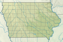
Denison Municipal Airport (IATA: DNS[2], ICAO: KDNS, FAA LID: DNS) is a city-owned, public-use airport located two nautical miles (4 km) southwest of the central business district of Denison, a city in Crawford County, Iowa, United States.[1] It is included in the National Plan of Integrated Airport Systems for 2011–2015, which categorized it as a general aviation facility.[3]
- ^ a b FAA Airport Form 5010 for DNS PDF. Federal Aviation Administration. Effective November 15, 2012.
- ^ "IATA Airport Code Search (DNS: Denison Municipal)". International Air Transport Association. Retrieved August 4, 2013.
- ^ "2011–2015 NPIAS Report, Appendix A" (PDF). National Plan of Integrated Airport Systems. Federal Aviation Administration. October 4, 2010. Archived from the original (PDF, 2.03 MB) on 2012-09-27.

