This article needs additional citations for verification. (December 2017) |
Devore | |
|---|---|
| Devore Heights | |
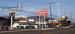
 Roadside business in Devore along former historic U.S. Route 66 (Cajon Boulevard) | |
| Coordinates: 34°12′59″N 117°24′05″W / 34.21639°N 117.40139°W | |
| Country | United States |
| State | California |
| County | San Bernardino County |
| City | San Bernardino |
| Elevation | 2,510 ft (770 m) |
| Time zone | UTC-8 (Pacific (PST)) |
| • Summer (DST) | UTC-7 (PDT) |
| ZIP codes | 92407 |
| Area code(s) | 909 and 840 |
| GNIS feature ID | 270868 |
Devore Heights, or Devore, is a residential rural neighborhood of the city of San Bernardino, California. It is located just north of the junction of Interstate 15 and Interstate 215, about 12 miles northwest of downtown San Bernardino. It is also the last town to pass through before taking the Cajon Pass to reach Hesperia, California. The area is just outside the boundaries of the San Bernardino National Forest; nearby cities and communities include Verdemont, University Hills, Rancho Cucamonga, Fontana, and Rialto. Glen Helen Pavilion/Amphitheater, the largest amphitheater in North America, is located just south of Devore. Devore is completely within the city's 92407 ZIP Code and is within the 909 and 840 area codes as well.

