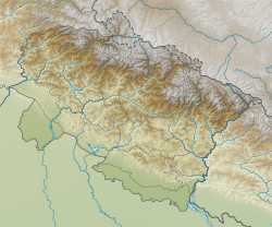
Didihat | |
|---|---|
Town | |
 Didihat Town and Panchachuli peaks in the background | |
| Coordinates: 29°47′58″N 80°14′10″E / 29.7994255°N 80.2362226°E | |
| Country | |
| State | Uttarakhand |
| Division | Kumaon |
| District | Pithoragarh |
| Area | |
| • Total | 4 km2 (2 sq mi) |
| Elevation | 1,850 m (6,070 ft) |
| Population (2011) | |
| • Total | 6,522 |
| • Density | 1,600/km2 (4,200/sq mi) |
| Languages | |
| • Official | Hindi |
| Time zone | UTC+5:30 (IST) |
| PIN | 262551 |
Didihat is a town and a Nagar Palika in Pithoragarh District in the state of Uttarakhand, India.[1] It is one of the eleven administrative subdivisions of Pithoragarh district and also serves as its administrative headquarter.[2] With a population of 6522, Didihat is located at a distance of 415 km (258 mi) from the state capital Dehradun.[3]
Didihat is named after the Kumauni word 'Dand' meaning a small hillock. Didihat falls on the pilgrimage route to Kailash Mansarovar.[4] Earlier it was known as “Digtad”. Present day name Didihat is derived from Hat Tharp village which is the heart of this town.
- ^ District Nagar Panchayat, Nagar Panchayats in Uttarakhand (PDF). Retrieved 1 November 2016.
- ^ Indusnettechnologies, Goutam Pal, Dipak K S, SWD. "District Profile: District of Pithoragarh, Uttarakhand, India". pithoragarh.nic.in. Retrieved 18 October 2016.
{{cite web}}: CS1 maint: multiple names: authors list (link) - ^ "Didihat Distance Chart - Road Distance to Didihat by Car Bus". www.euttaranchal.com. Retrieved 20 March 2021.
- ^ Chamaria, Pradeep (1996). Kailash Manasarovar on the Rugged Road to Revelation. Abhinav Publications. p. 41. ISBN 9788170173366. Retrieved 26 October 2016.

