Diori Hamani International Airport | |||||||||||||||
|---|---|---|---|---|---|---|---|---|---|---|---|---|---|---|---|
 | |||||||||||||||
| Summary | |||||||||||||||
| Airport type | Military/Public | ||||||||||||||
| Owner | Transports de Niamey | ||||||||||||||
| Operator | Summa Airports Niger SARLU | ||||||||||||||
| Serves | Niamey, Niger | ||||||||||||||
| Location | Niamey, Niger | ||||||||||||||
| Hub for | Niger Airlines | ||||||||||||||
| Elevation AMSL | 732 ft / 223 m | ||||||||||||||
| Coordinates | 13°28′54″N 002°10′13″E / 13.48167°N 2.17028°E | ||||||||||||||
| Website | http://niameyairport.com | ||||||||||||||
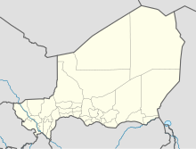
| Map | |||||||||||||||
 | |||||||||||||||
| Runways | |||||||||||||||
| |||||||||||||||
| Statistics (2013) | |||||||||||||||
| |||||||||||||||
Diori Hamani International Airport (IATA: NIM, ICAO: DRRN) is an airport in Niamey, the capital of Niger.[3] It is located 9 km (5.6 mi) from Niamey in the south-eastern suburbs of the city, along the Route Nationale 1, the major highway linking Niamey with the east of the nation. The airport complex also includes the major base for the Armed Forces of Niger's "Armee d'Air".
- ^ "Aeronautical chart" (PDF). Archived from the original (PDF) on 21 February 2017. Retrieved 11 September 2008.
- ^ List of the busiest airports in Africa
- ^ "Attributions des départements de l'ANAC Archived 4 June 2013 at archive.today." Agence nationale de l'aviation civile du Niger. Retrieved on 3 June 2013.
