| Dismal Swamp State Park | |
|---|---|
 State park entrance bridge on the Dismal Swamp Canal. | |
| Location | Camden, North Carolina, United States |
| Coordinates | 36°30′46″N 76°24′59″W / 36.51278°N 76.41639°W[1] |
| Area | 14,432 acres (58.40 km2)[2] |
| Elevation | 16 ft (4.9 m)[1] |
| Established | 1974[3] |
| Named for | Great Dismal Swamp |
| Operator | North Carolina Division of Parks and Recreation |
| Website | Dismal Swamp State Park |
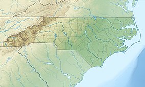
Dismal Swamp State Park is a North Carolina state park in Camden County, North Carolina, in the United States. The park was created as a state natural area in 1974 with the help of The Nature Conservancy, and on July 28, 2007, the North Carolina General Assembly re-designated it as a state park.[4] It opened to the public in 2008.[5] This marked the first time that public access to Great Dismal Swamp was made possible in North Carolina.[6] The park covers 14,432 acres (58.40 km2) of protected land on the North Carolina/Virginia border. Park offices are 3 miles (4.8 km) south of the border on U.S. Route 17 near South Mills. Features of the park include the canal which is used regularly by boaters using the Intracoastal Waterway and several miles of hiking and biking trails.[7]
- ^ a b Cite error: The named reference
GNISwas invoked but never defined (see the help page). - ^ Cite error: The named reference
ParkSizewas invoked but never defined (see the help page). - ^ Cite error: The named reference
ParkDirwas invoked but never defined (see the help page). - ^ Cite error: The named reference
ReDesignationwas invoked but never defined (see the help page). - ^ Cite error: The named reference
Dedicationwas invoked but never defined (see the help page). - ^ "Dismal Swamp State Park". ICW NET, LLC. Archived from the original on October 3, 2008. Retrieved September 23, 2008.
- ^ "Dismal Swamp State Park". North Carolina Department of Environment and Natural Resources. Archived from the original on January 30, 2009. Retrieved September 23, 2008.

